First, let's take a look at how much snow has fallen so far this February based on reports we've received through the 17th along with the February record for the entire month.

As you can see, most places still need quite a bit of snow to threaten the February record but more is coming. At this point Saint Maries, La Crosse, and Nez Perce have the best chances of breaking the record.
Here is where Spokane ranks as of February 17th with the top 10 February events listed

There is a very good chance Spokane will rise into 2nd place by the end of this week.
Now let's take a look at the week ahead.
Tuesday/Wednesday Storm
Another storm arrives Tuesday afternoon and lingers into Wednesday. Here is one model depiction of the weather pattern.
 |
| 00z/18th GFS Model forecast of 500mb heights and 700-500mb Relative Humidity valid 4 AM PST Feb 20th, 2019 |
This pattern sure looks familiar. Strong high pressure off the coast with another storm dropping in from the northwest. Note all the green shade over the region indicating high moisture content and thus the snow.
Here is the same model showing precipitation timing of the storm

Snow looks to begin Tuesday afternoon, likely impacting the Tuesday evening commute. Now for the rest of the images.


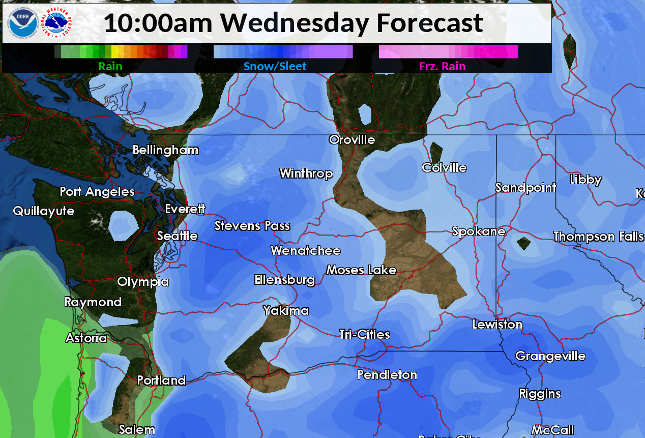


This will be a prolonged snow event for some locations with the longest duration expected over SE Washington. Expect impacts to the Tuesday evening and Wednesday morning commute. Here is our forecast as of Monday morning for expected snowfall totals.

Models have been pretty consistent and are in agreement with this storm so there is moderate confidence in these amounts. As always we will continue to fine tune the forecast for this storm. Please go to our web site here for the latest forecast for your area.
Friday/Saturday Storm
There will be a short break on Thursday before yet another system arrives. Does the weather map look familiar?
 |
| 00z/18th GFS Model forecast of 500mb heights and 700-500mb Relative Humidity valid 4 PM PST Feb 22nd, 2019 |
Models are coming into good agreement of more snow, but differ with the details of how long this storm remains over the region. This storm has the potential to produce as much if not more snow as the Tuesday/Wednesday one. Stay tuned!
No comments:
Post a Comment