Monday, December 22, 2014

Odds for a White Christmas: Update

OK, we're only 3 days away from the Big Day, and snow is still hard to come by in my Inland Northwest locations.  Is there any hope for a White Christmas?  Here's the current snow depth analysis:


Pretty pathetic.  Folks in the Cascades are doing well, as are those in some of the northern valleys (e.g. Omak, Republic, etc).  Otherwise, lots of bare ground.  

Just to refresh your memory, here was last year's snow cover at this same time. Not stellar, but better than this year.


But there's still time to change this, right?  Actually, the answer is "yes", for some locations anyway.  As we've been discussing in earlier blogs, the computer models have been suggesting a Christmas Eve storm for over a week now, but they've been waffling on the exact timing, track, etc.  And these small differences play a HUGE role in who will get precipitation, and in what form will it fall.  But now, the models are in fairly close agreement. So let's take a look at what they're saying.

Below is the GFS forecast precipitation for the 12 hours ending 4pm Wednesday.


While this looks encouraging, unfortunately almost all of this will fall in the form of rain.  Snow levels during the morning hours will be around 6000' but will rapidly fall through the day as cold air moves in from the north.  Can the snow levels drop all the way to the valleys before the precipitation ends?  Maybe, but this is typically a poor pattern for valley snow.  And even if it does snow in the valleys, it will have a hard time accumulating on the ground during the afternoon/evening hours.

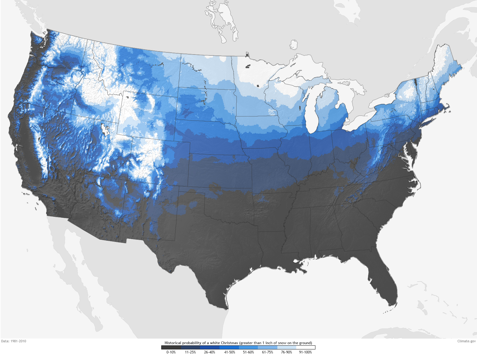
Here's the probability of 1" or more snowfall on Christmas Eve. 


Things are looking up for folks in the Idaho Panhandle.  Meanwhile things look bleak for locations in central/eastern Washington, with locations west and south of Spokane having next to no chance for snow.

So, looks like a brown Christmas for many folks.  The interesting climate tidbit in all this is that we could set an obscure record at Spokane.  The latest that it's ever taken for the Spokane Airport to have it's first 1" or greater snowfall from one storm is Dec 24th 1976.  Unless the forecast changes in a hurry, we'll break that record.  But not by much.  Why you ask?  Because it's is now looking very good for a decent snow event after Christmas.

Here's the 24-hour precipitation forecast from the GFS ending Saturday evening:


Looks similar to the Christmas Eve storm, right?.  The difference is that just about all of this will fall in the form of snow instead of rain.  The reason is that while the Christmas Eve storm might not bring much snow, it will bring colder air.  So by the time this second storm arrives, we'll be much colder.  Different models have different amounts of snow, but in general they all have a solid 2-4" for most locations with the potential for higher amounts.

Here's the snowfall forecast from the NAM (red) and GFS (blue/purple) for Spokane. 


There are different forecasts here using different techniques.  But in general they give a similar message.  Snow will start Friday evening and continue into Saturday evening.  The ECMWF (not shown) has a similar story, but doesn't start the snow until Saturday morning and continues it into Sunday.  Either way, there is the potential for several inches of snow.

It's too early to hang-your-hat on this forecast.  But one of the things we like to see is that each model forecast is similar to the previous one (GFS runs every 6 hours, ECMWF every 12).  And they've been saying a similar message for about the last 24 hours.  So that's a good sign and gives us confidence that this forecast could indeed pan out.  But the overall pattern for this storm isn't necessarily a favorable one for heavy snow in the Inland Northwest.  The mountains will almost assuredly pick up some snow from this, but the lower elevations might not see much. Stay tuned to the forecast, especially if you plan to travel this weekend.


Wednesday, December 17, 2014

Are the chances of a White Christmas improving?---UPDATED 12/18/14

...Here's an update to yesterday's blog. We replaced the images with the latest weather forecasts...  

 Since our last post, we have gotten a little more resolution on the prospects of seeing a White Christmas across the Inland Northwest. But before we answer that question we need to deal with a weak weather system tonight and Friday and then a much stronger system for the weekend. As of our latest forecast (issued 3pm Thursday). Tonight and Fridays weather system is calling for light snow, mainly confined to the mountains. Valley snow chances will be reserved for the Cascade valleys, Okanogan Valley, and a small part of the Waterville Plateau. These locations will generally see amounts ranging from 1-3 inches with locally heavier amounts near the Cascade Crest. There will likely be some travel concerns going over the Cascade passes.


Snow forecast for tonight-Friday

The storm system for Saturday and Sunday stands a much better chance of producing significant snowfall as it will contain much more atmospheric moisture. This will be care of a very well-defined atmospheric river that has its sights set on the Pacific Northwest. Here's what the atmospheric river is expected to look like by Saturday morning. This river will draw its moisture from well south and west of Hawaii.
Atmospheric river forecast for Saturday morning. The darker the colors, the more moisture content. 

While the river will assuredly produce widespread precipitation, it will also deliver steadily warming temperatures. Our confidence is high that snow levels will be low enough to produce moderate to heavy snows near the Canadian border and in the Cascades. It would not be surprising to see snow amounts approach a couple feet in the Cascades.  Meanwhile, the forecast for the nearby valleys is a much tougher call as temperatures will be critical. If they warm much above 32°F the snow accumulations could be less than forecast, in fact much less. Right now, we are forecasting temperature very close to freezing over most of these lower elevation locations and putting moderate snow accumulations in the Cascade Valleys. Most of this valley snow threat would occur between Saturday morning and early Saturday evening.

Weekend Snow forecast

By Sunday afternoon, temperatures will warm significantly as the warmth associated with the sub-tropical moisture continues its northeastward surge. Snow levels will rise to 4000' or higher over the entire Inland Northwest. This will translate to melting snow over most of these valley locations. The big question is can we melt what falls? That depends on how much accumulates over these locations. The warming will be accompanied by breezy conditions which will help melt the snow especially as the dewpoint temperatures and nighttime lows rise above freezing. And that's what we are expecting as of our latest forecasts. Here's a look at the high-temperature forecast for Sunday.

Sunday Forecast Highs

 So based on the current forecast the only valley locations which stand a chance of snow before Christmas Eve would be near the Canadian Border, or the Cascades. How about the remainder of the region? Well, as we talked about in our last blog entry we are expecting a big pattern change, right around Christmas Eve. That's still true. Our mild west-southwest flow of late will take a decided cooler turn to the northwest. Here's what the upper-level pattern is going to look like (at least something like it anyway). The wind flow will be parallel to the yellow height lines and it will deliver cooler air into the area (blue and purple shading is cold air, other colors are relatively warm) via the Gulf of Alaska. Meanwhile, the remnants of the weekend moisture stream will get hung up somewhere over the Pacific Northwest. The big question is where is that going to happen? Most likely it will occur immediately downstream or east of the curve in the yellow lines. In the picture below that suggests that will be somewhere over extreme southern Washington and northern Oregon.


500 mb Heights and temperatures

So is there good model agreement in where that curve is going to form? That is the key to this forecast. As of the latest model runs, consensus is growing. Here's a look at four various model runs all looking at the afternoon hours of Christmas Eve. We placed the precipitation forecast on top of the 500 mb yellow height lines. Notice, they all show a similar curve in the height lines or flow, however they vary on how far north to place it.  Model trends continue to support the band forming well south of I-90. Notice some don't place any precipitation over eastern Washington, while others only give us light precipitation amounts. Based on the trends, our confidence in seeing precipitation remains highest for locations near the Oregon/Washington border, such as Lewiston and Pullman. However, even in these locations temperatures may remain just a little too warm for snow.

Various weather models for Christmas Eve. Shading represents the precipitation. 


So to answer our original question. Are the chances for a White Christmas improving? For locations such as Mazama, Republic, or Plain the answer is a decided yes. For Lewiston or Pullman the answer is a maybe. Folks in Spokane, Couer d'Alene, Moses Lake, or Wenatchee the odds are not great. Of course, Christmas Eve is just under a week away and much can change between now and then. So stay tuned and maybe just maybe the yellow curve will decide to set up over the entire Inland Northwest resulting in a White Christmas for all. 

Monday, December 15, 2014

Looking for significant snow? Is there any hope soon?

  Well, another week into December and much of the Inland Northwest has yet to see any significant snow. The only exceptions have been near the Cascades and a small part of the Okanogan Valley. As of this afternoon, here what the snowpack summary looked like. Notice there is very little if any snow in the valleys. If you wanted to see significant snow, you'd have to trek into the mountains north and west of Wenatchee and Omak  or north of Sandpoint.
Snow depth as of 5pm Monday 12/15/14
Although these areas were shaded in purple indicating anywhere from 20" to 50" of snow on the ground, that pales vs. where we are supposed to be this time of year. Here's a look at the amount of water that's in the current snowpack. Generally speaking, it's right around half of where it should be this time of year (orange shading) and is actually far worse across most of the Cascades!

Snow water equivalent vs. normal

So is there any hope we can add some more snow to the forecast this week? Actually there is some hope however it won't add up to much. We have several weak weather systems set to impact the Inland Northwest this week. The first will arrive late tonight and into Tuesday. For now, here is our forecast of snow.
Snow forecast for late tonight-Tuesday
As you can see we have light snow forecast across much of the region. We are most confident about the snow totals near the Cascades and northern Valleys. Elsewhere, it looks like the snow might begin too late in the day so it might make accumulations difficult to come by. But that's not the only hope for snow. A couple weak disturbances look like they will impact the region through the remainder of the workweek. Here's our latest forecast of snow for late Thursday through Friday night. Confidence is not high as these will be weakening and warming winter storm systems. Temperatures away from the Cascades and northern valleys could be marginal for snow, especially accumulating snow.

Snow potential for Thursday afternoon-Friday night
Even if the snow materialises, it won't likely stick around long as we will see a yet another round of very warm and wet weather. This weather will be brought to us by another atmospheric river or Pineapple Express. Here is the model depiction of the latest plume. The moisture is represented by the stream or river of greens colors extending across the eastern Pacific to the Washington Coast. Notice the plume originates to the west of Hawaii (lower left corner of the picture), suggesting it will be a very juicy airmass. Temperatures should surge well above freezing over most locations which will melt most of not all of the valley snow which falls this week.
Atmospheric river forecast for Saturday

So this warm air is only forecast to persist through Monday night or so which doesn't bode well for a White Christmas. But is all hope lost? First off this would be a good time to show what the climatological odds are of seeing a White Christmas. There is a very large variability across the Inland Northwest ranging from near 100% for the northern valleys of Washington, and most of the Idaho Panhandle to less than a 25% chance by the time you go south toward the Tri-Cities and Lewiston. For a more detailed look of the map below check out this link from the National Climate Data Center.

Odds of a white Christmas. 
So enough about climatology, what about this years weather? There are actually some good indications that we could see a moderate to major winter storm on Christmas Eve. Well, why is that? It looks like we will see a very good setup where the moisture from early next week sticks around and is intercepted by much cooler arriving from the northwest.
500 mb pattern showing northwest flow from BC and Gulf of Alaska

Notice the kink in the flow setting up near the Washington/Oregon border. Where this sets up gives us a clue for where we can expect the heaviest snow.While there are model uncertainties as to where this kink sets up most of the model solutions are showing this. Here's a look at several solutions for Christmas Eve. Notice they are all showing a band of moderate to heavy precipitation (purple and red shading), they differ significantly on where to place the band.
Various model solutions for precipitation on Christmas Eve
 As this forecast period nears, we should be getting a better handle on where the band of precipitation sets up. The good news is whatever falls should easily fall as snow as we rid ourselves of the above freezing temperatures. So if you are wishing for a White Christmas this year, your wishes just might come true!

Monday, December 8, 2014

Where's the Snow?

We're now into the second full week of December, and most of us in the Inland Northwest haven't seen much snow yet.  The notable exception is the folks in the Methow Valley, which received up to 18" from a storm just before Thanksgiving.  Outside of that, most locations have seen a dusting here, half an inch there, but nothing that survived for very long.  

So the first question often is "Has this ever happened before?"  Our climate records for this area generally go back into the early 1900's with some sites having data into the late 1800's.  And some sites have good, continuous data, while others are a bit spotty.  So lets take a look at a few sites that have good data and are representative of the area.

First we have to define how to look at the early season snow.  The first measure is fairly obvious: "How much snow do we normally have by this date?"

Location
Avg Snow through   7 Dec
Total Snow 
7 Dec 2014
Lowest Snow through 7 Dec
Spokane Airport
9.6”
0.9”
0.3” in 1954
Wenatchee WP
3.8”
2.3”
0” in 2012
Moscow
7.6”
2.0”
0” in 1904
Priest River
13.9”
4.6”
0” in 2002
Republic
9.3”
10.7”
Trace in 1943
Winthrop
15.9”
20.0”
Trace in 1969
Kellogg
7.4”
1.7”
0” in 1920

As you can see, in most locations, we're behind our Average snow fall through December 7th.  But we're still doing better than other bleak years.  So no records there.

Another way to look at it is the average date of the first inch of snowfall. 

Location
Avg Date First 1” Snow
2014 First 1” Snow
Latest First 1” Snow
Spokane Airport
Nov 19th
Not Yet
Dec 23rd 1976
Wenatchee WP
Dec 6th
Nov 22nd
Feb 1st 1963
Moscow
Nov 22nd
Nov 29th
Jan 4th 1990
Priest River
Nov 14th
Nov 25th
Dec 15th 1926
Republic
Nov 13th
Nov 22nd
Dec 23rd 1976
Winthrop
Nov 12th
Nov 22nd
Dec 11th 1936
Kellogg
Nov 20th
Dec 4th
Dec 25th 1954

Again, most locations got a late start, but nothing that would break any records.  The exception is the Spokane metro area, which has yet to even have it's first inch of snow.

So what's been the cause of this lack of snow?  Here's the average temperature for the Nov 1st - Dec 5th period.


As you can see, for the past 30 days it's been actually colder than normal for the Inland Northwest.  Of course, this is an average of 2 cold snaps with some rather mild weather in between.  Here's the daily temperature data for Spokane:


The blue bars are the daily temperatures, while the red and blue shading shows the daily records.  Spokane hasn't had any record highs or lows during this period, but they've come close.  The mild temperatures are certainly not conducive to snow.  But what's frustrating is that the cold snaps didn't equate to much if any snow.  Typically, cold air that moves in from Canada is very dry and doesn't provide much snow, which was the case with both of these systems.  But then eventually a Pacific storm will bring moisture into the area and it will fall as snow until the cold air can be pushed out of here.  But in both of these events, that didn't happen.  Instead, the Pacific storm went south of our area, leaving the Inland Northwest largely dry.

The percent of average precipitation shows that after a promising start to the wet season in late October, we've been fairly dry over the past 30 days.


So what has this meant for the mountain snow pack?  It's not good.  Here's the Snow Water Equivalent (SWE) analysis (i.e. how much water is in the snow that's on the ground).  The color shading represents the comparison of this year to how much is typically in the snow pack by December 8th:


It shows that most of our area is lagging behind normal at this point.  While this is bad news for ski enthusiasts, it's way too early to worry about it from a water supply standpoint.

Is there any hope of a change in the weather?  Not really.  Here's the 8-14 day outlook for temperatures and precipitation from the Climate Prediction Center (CPC).


The folks at CPC see warmth for next week across just about the entire US, while precipitation is expected to be near to below normal for mid-December.  This is an average outlook for a 7 day period.  So there can still be a weak snow event buried in there, but it's not likely.  And since this outlook ends on December 22nd, the issue of a White Christmas is starting to come into play.


Thursday, November 13, 2014

Winter 2014/15 Outlook

One of our most asked questions is "What is the winter going to be like?"  In this blog, we'll try to answer that question as best we can.  As most people know, looking this far into the future is more of an "Outlook" than a "Forecast".  

Most everyone has heard of El Nino and La Nina, especially when we're talking about the winter outlook.  We often refer to this as ENSO (El Nino Southern Oscillation)  There are other "oscillations" in the atmosphere that affect our weather.  However, ENSO is the only one that is linked to the ocean temperatures.  This is important for two reason.  First, we have some skill at forecasting ocean temperatures. Second, the ocean temperatures don't suddenly change.  These two facts allow us to predict the atmosphere several months into the future.  Most of the other oscillations are purely atmospheric.  As such, we can predict them only 1-2 weeks into the future with any skill.  What does all of this mean?  ENSO is just one of the influences on our winter weather, and the only one that we can predict with any skill.  The other oscillations are less predictable, and could alter or even override the effects of ENSO.  So let's first take a look at what is the state of ENSO.

The area of the Pacific Ocean that is monitored for El Nino is shown in the figure below.
ENSO Monitored Regions

The Nino 3.4 is the most critical area, although the other regions also play a role.  What is monitored is the Sea Surface Temperatures (SSTs) in this area.  And the main way to look at these is to observe how the temperature compares to what we "normally" observe in this area.  This comparison is referred to as an "anomaly".  For El Nino, the anomaly must be 0.5C warmer than normal for 5 months.  La Nina is defined as an anomaly of 0.5C cooler than normal.

Currently, the SST anomaly in the 3.4 region is very close to 0.5C.  It's actually been close to that value since early summer, but decline a bit in August before warming this autumn.


Sea Surface Temperature Anomalies in the 4 NINO regions

So the Nino3.4 region is already close to the 0.5C criteria for El Nino.  So what is the forecast for the SSTs?  Here's a figure that shows a number of numerical predictions from several different countries.


This graph shows that the majority of forecasts lie between the 0.5C and 1.0C lines through the winter and next spring.  This would equate to a "weak" El Nino.  There are a few that expect a somewhat stronger El Nino, as well as a few that are predicting no El Nino.  

Here's the prediction from a number of runs from the U.S. CFS model:


Again, the majority (but not all) of the forecasts are between 0.5 and 1.0C, with additional warming during the summer.  The European climate model has a similar forecast:

So the take-away from all of this is that the majority of computer forecast are expecting a weak El Nino to persist through the winter and into the Spring of 2015.  The latest NOAA Climate Prediction Center discussion states that there is a 58% chance of an El Nino.  

The affects of El Nino on North America weather are fairly well understood.  And these are reflected in the official winter outlook from NOAA:


For the Pacific Northwest, the expectation is for warmer and drier conditions than normal.  And this fits what we commonly see in our area during an El Nino winter.

Here's a bar chart showing the observed temperatures at Spokane for the winters since 1949/50.  The bars are colored in red (El Nino), blue (La Nina), and white (neutral).  The black horizontal line represents a "normal" winter.


As you can see, just about every red bar (El Nino winters) is above the black line, meaning that the El Nino winters are warmer than normal.  

A similar graph for precipitation is found below:


In this instance, you can see more variability with the red bars.  Some El Nino winters are wetter than normal, others are drier than normal.

The third graph shows the occurrence of snow.


This is a fairly clear signal.  We haven't seen an above-normal snowfall El Nino winter since 1977/78.  Most El Ninos bring below normal snowfall to the Inland Northwest.

So the outlook for this winter in the Inland Northwest is for above-normal temperatures, with below-normal snowfall.  But as was earlier stated, this is by no means a done deal.  The other atmospheric oscillations could still alter the weather beyond the affects of ENSO.  Additionally, this is an outlook for the entire winter.  So there could still be a frigid or snowy week or two.  But when the winter is all said and done, we'll probably look back at it as a milder winter.


Friday, November 7, 2014

Winter Arrives Tuesday

We've had unprecedented warmth this Autumn season.  But all that is about to end.  First, let's take a look at how warm it's been.  

October was a record warm month is some locations.  Here's a quick table showing the warmth:


  •  Wenatchee
    • Oct 2014: 56.6F - 2nd warmest October
    • Record: 57.3F in 1988
  • Spokane
    • Oct 2014: 53.3F - 5th warmest October
    • Record: 54.5F in 1952
  • Lewiston
    • Oct 2014: 57.9F - 3rd warmest October
    • Record: 58.7F in 1988
The warmth actually extends back into mid-September.  Here's a graph of the temperatures at Spokane Airport for the last 2 months:


The blue bars are the observed high and low temperature this year.  The brown shading is what we typically see for temperatures on these days.  And the blue and red lines are the coldest/warmest temperatures ever observed.  So you can see that we didn't set any daily records at Spokane.  But notice how the observed temperatures were consistently above normal, with just a few cool spells.  Add to that, Spokane didn't reach the freezing mark until Nov 2nd, which ties with 2005 as the latest ever for the Airport first freeze.  

But as we said, all of that is about to change, and in a big way.  Here's the weather pattern that is going to do it.  Below is a depiction of the temperatures at about 5000' above sea level for this afternoon (Friday 7 November):

850mb Temperatures Friday afternoon 7 Nov 2014

This image shows that the coldest air is over north-central Canada with mild air over all of the western US.  Below is a forecast for Monday morning:

850mb Temperatures for Monday morning 10 Nov 2014

Now the cold Canadian air has penetrated into the northern tier of the US.  You can see that the Inland Northwest is right on the edge of the cold air.  By Wednesday morning, even colder air has made its way into the lower 48:

850mb Temperatures for Wednesday morning 13 Nov 2014

By this time, cold air has completely moved into all of Washington and Oregon east of the Cascades.  Even Portland will probably see some cold air seep through the I-84 Gorge.  Also note how far south the cold air will move in the central US, all the way down to the Texas Panhandle.  The coldest air will be over Montana into the Dakota, but the Idaho Panhandle will still be plenty cold.

What's causing this pattern shift?  In part, it's Super-Typhoon Nuri in the western Pacific.  Nuri developed east of the Philippines on Halloween, rapidly strengthened, and "recurved" into the westerlies.  The CIMMS blog has some great satellite images of it.   

As Nuri moved northward, it converted to an extra-tropical cyclone, and has currently become a massive storm in the Bering Sea.  So why does this affect our weather?  First, he's a graphic showing the jet stream today.


Jet Stream analysis Friday 7 Nov 2014


The yellow line represents the jet stream.  As you can see, the jet stream is coming at us from a very southern latitude, just north of Hawaii.  But as Nuri's remnants develop and move into the Bering Sea, the weather pattern will shift.  

Jet Stream forecast Monday 10 Nov 2014

By Monday, the jet stream will be directed from the central Pacific into Alaska, where it will pick up cold Canadian air, and bring it southward into the lower 48 states.

So how cold will it get?  Here's the forecast high temperatures for Tuesday.


That's right.  High temperatures on Veteran's Day will be below freezing for much of the Inland Northwest.  And here's the forecast low temperatures for Wednesday morning:


Yes, you're reading that right.  Low temperatures in the teens in many places.  This is way colder than anything we've seen this Autumn.  If you've been putting off those Fall Chores (e.g. blowing out sprinklers, putting away hoses, etc), this weekend will be your last chance to do that.

And with these temperatures, people will naturally be wondering if there's any snow that will come with it.  About the only chance for snow will be in the northern Panhandle and northeast Washington on Sunday Night and Monday Morning.  Here's the current forecast: