Yet another winter storm will impact the region through Wednesday delivering more moderate to heavy snowfall. In this blog we will discuss this in more detail including start and end times and snow amounts so let's get to it.
Here is an Infrared Satellite image from 1 PM this afternoon (Monday). The low center was off of Vancouver Island with a deep fetch of moisture noted by the cooler (green shade) cloud tops aimed at the region.
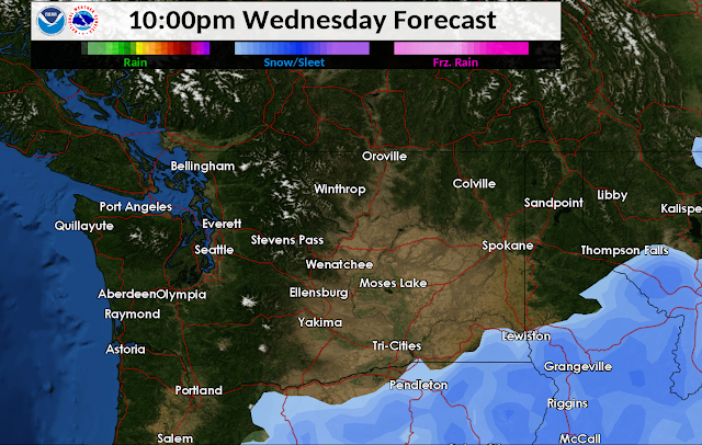
When will it start? Well as of 3 PM is had already started in Wenatchee, Moses Lake, Pullman, Lewiston, Spokane and heading northeast. Here is the 12z GFS model depiction of how this storm will evolve. Will look at individual time steps of precipitation going into Wednesday. Blue is snow with darker blue shade indicating greater intensity. Green is rain, and pink is a mix.
You can see the main snow event in terms of snow intensity will be tonight into Tuesday morning becoming more focused to the Cascade crest and Idaho Panhandle Tuesday afternoon. Worth noting on Tuesday is milder temperatures and even above freezing over parts of Eastern Washington and north Idaho. Here are Tuesday's forecast high temperatures
We could also see wind gusts of 20-30 mph around Ritzville, Spokane, and Pullman creating patchy drifting snow. The snow transitioning to the wet variety combined with the milder temperatures should keep this patchy in nature but local impacts are still possible.
This essentially ends phase 1 of the storm. We will get to Phase 2 in a minute. First here are the snow totals for tonight.
And now Tuesday:
Phase 2 will feature a secondary surge of snow, with current models showing another round of snow moderate to heavy snow accumulations for SE Washington into the Central Panhandle Mountains. Spokane and Coeur d'Alene may see additional accumulations as well.
Here is 4 AM Wednesday per the GFS model
And 4 PM Wednesday
And finally, the storm exits Wednesday evening
Here the projected snow amounts for Tuesday night
And Wednesday
Now, if we add all of this up, here is what we get
Now keep in mind this is a long duration accumulation forecast, and there will be a period of above freezing temperatures for some areas such as Pullman on Tuesday. So the total snowfall forecast may not achieve these numbers from a snow depth change perspective. This is an evolving situation so please check our website here for the latest forecasts, advisories, and warnings.
Stay safe out there as winter driving conditions continue.


No comments:
Post a Comment