Showing posts with label high wind. Show all posts

Friday, November 4, 2022

Storm Part 2...Will your house have electricity in the morning plus a look beyond?

There's a good chance of seeing multiple power outages tonight with our upcoming wind storm.  And depending on how many outages there are, our much-appreciated hard working utility folks may not have all the power back on before you get up Saturday morning.  As such, you may want to make some contingency plans.  It would be a good idea to charge your battery powered devices this evening just to be safe. 

Round 1 of our storm series is over. The main result of it was heavy snow which fell over many parts of the Inland Northwest overnight and into this morning.  It is very unusual to have this much snow this early in the season, let alone for the first snow of the season. Here are the morning snow totals.  Since it snowed much of the morning, these totals will likely increase from what's posted here.


Now it's time to get ready for Round 2 and it could be a doozie: the wind storm.  The various computer models have their usual disagreements, but they're all saying it's going to be windy tonight.  One chart we often look at for wind events is the 850 mb wind forecast.  Think of this as the winds about 3000-5000 feet elevation.  Usually a wind of about 50 knots (58 mph) will get our attention.  In this instance, the GFS is forecasting 65 to 78 knots of wind tonight!  Other models so something of a similar magnitude.

850 mb winds for 11PM Friday

So the question is: can that wind that is 3000-5000 feet overhead mix down to the ground?  The answer is quite complicated and difficult to answer.  Meteorologists often struggle with this a lot.  In some instances, those strong winds above us stay above the ground and we never feel them.  But there are situations where those strong winds do make it to the surface.

One of those mechanisms is cold fronts.  And that's exactly what we'll have moving through our area tonight.  The front is moving west to east, and will go through Spokane around 1am tonight.  Before that, the rain in the Spokane area will taper off around 6pm, and then the winds will begin to crank up.  It will be windy with gusts up to 50 mph late this evening and then the front plows through. We still think there is a good chance that when the front goes through, we will see wind gusts in the 60-70 mph range for some locations.  The damaging winds should begin to taper off  before sunrise Saturday.

Here's the peak wind forecast.  Keep in mind that the valley locations like Colville and Republic may not see the highest wind speeds, but they have more trees to potentially knock down and thus produce more power outages. 


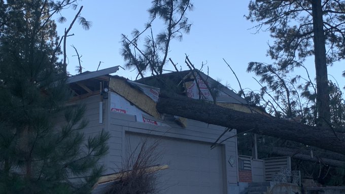
So what can we expect from an event like this?  At this point, there are some similarities between this event and the 13 Jan 2021 event.  That event had 850mb winds of 57 knots just before the cold front came through, which resulted in a gust to 71 mph at Spokane Airport.  But similar to tonight's event, the strong winds only lasted about 3 hours.  Still, the tree damage was significant, and power outages lasted for several days in some locations.


After the wind storm, we aren't done with the active weather, we still have Rounds 3 and 4 to contend with. 

Round 3 promises to deliver more snow, and in some cases it could be significantly more than what we just saw. The heaviest snow possibilities are honing in on north-central Washington.  The surface low will track south of us, which favors that part of the Inland NW due to easterly low-level winds pushing into the Cascades. This will cause rising air over much of that area, rather than the more typical downslope/rain shadow effect.  Snow should start there on Sunday morning.

Surface low position (off Vancouver Island at 11 am Sun) and precipitation

But since this low is tracking south of us, the front will move very slowly across the region.  It won't reach extreme eastern WA and the Panhandle until 24 hours later, Monday morning.

Surface low position and precipitation as of 11 am Monday

Here's the current forecast storm total snow for this event.  


And lastly, Round 4 will be the unusually cold temperatures that move into the region behind this storm.  There's a good chance that some locations will break daily records.  Here is a list of the record highs which could be broken (denoted in yellow):


As well as the record lows (denoted in yellow):


If there are widespread power outages from the wind or upcoming snow event, the cold temperatures next week could have a much bigger impact than they usually would. 


Wednesday, January 8, 2014

Snow, Rain, Wind, (and Thunder?)

Yesterday's weather system brought a nice 1 to 3" of snow to many locations.  You can see an extensive list of snow reports on the National Weather Service website.  Now we have Storm #2 arriving 24 hours later.  This one will be a little different in a couple of ways.  First, this storm is a little wetter and more extensive than the first.  This means more people will see precipitation.  Here's the radar forecast from the HRRR model valid at 5pm this evening:


5pm radar forecast from the HRRR model

This is a forecast from a computer, not an actual radar image.  But it gives you an idea what the radar will look like around 5pm.  And just about everyone in the Inland NW will be seeing some sort of precipitation at this time.  Which leads us to the other difference.  While Storm #1 was all snow, this one will be more of a mixed bag of rain and snow.  The HRRR forecast for precipitation type at 5pm is shown below.


5pm precipitation type forecast from HRRR
This graph is a little hard to read, but the horizontal blue lines represent snow, while the vertical green lines are for rain.  The HRRR expects the precipitation by 5pm to be rain south of a line from Deer Park to Grand Coulee.  This includes Spokane and the Palouse.  The precipitation may initially start in the metro area as wet snow, but it won't be able to accumulate much and will change to rain later this afternoon. Also notice there are some small pockets of red scattered around the region. This represents a chance of freezing rain. If freezing rain really does occur it will be rather isolated and likely quite brief. 

Here's the storm total snow forecast from the National Weather Service.


Storm total snow ending 4pm Thursday


Most of the valleys across the north (Republic, Colville, Sandpoint) will see all snow and pick up 2-6" of snow, while the mountains will receive up to a foot.

Storm #3 will follow on Thursday afternoon/evening this will be a weaker system.  It will once again bring rain or snow to Spokane and the Palouse while the northern valleys will pick up a little more snow.

Storm #4 is still taking shape but it consistently looks like it will be the strongest of the bunch.   Today's GFS model forecast backed off a little from it's previous forecast, while some of the other models came out a little stronger today.  As a result, they're all in very good agreement at this time.  We often take this as a sign to increase our confidence in the forecast.  Even though they all agree, could they all be wrong?  Yes, but the odds are growing increasingly slim.  

Here's a breakdown of how this storm will unfold:
  • Precipitation will spread over the area on Friday around or shortly after sunset.
  • Spokane and the Palouse will see rain from this storm, with a possible mix of snow at the onset.
  • Saturday morning will be rainy and breezy.  Spokane will be in the lower 40s by sunrise and top out in the mid 40s during the day.
  • The northern valleys will start as snow and will accumulate a few inches.  They will gradually change to rain overnight.  Colville will probably change to rain before midnight, while Bonners Ferry could hold on to snow until Saturday morning.
  • The cold front will move through the area during the middle of the day.  Behind the front winds will really blow.  Below is our forecast peak winds for Saturday.  Areas in white can expect gusts in excess of 50 mph.

Peak wind gusts expected on Satuday

We will likely be issuing Wind Advisories for much of the area and possibly High Wind Warnings.  You'll want to stay tuned to this forecast.

Here's a couple of other things to consider with this storm.  The rain along with the melted snow won't be able to soak into the ground since the ground is solidly frozen (from our early December cold snap).  So expect some water  ponding, even on your lawn.

The other interesting tidbit is the outside chance of a thunderstorm.  Thunder?  In early January?  Yes, it's happened before, and this is pretty much the classic set up for it:  warm moist air ahead of a strong cold front.  Below is the SREF model probability of thunderstorms. 

24 hr thunder chances ending 10pm Saturday. 
You can see a small area of 10% over southeast Washington.  If thunder does occur, we don't expect to see hundreds of lightning strikes. However a few claps of thunder are a possibility especially over southeast Washington and the southern Idaho Panhandle, including Pullman and Lewiston.