
Well there is one way to measure the grounds need for water, and that is evaporation measurements. These are taken on a daily basis from April 1st - September 30th at NWS Spokane near Airway Heights. We call it EVAP for short. Here is a picture of one of our forecasters adding water to the pan as part of taking today's measurement.
 |
| NWS Forecaster Jeremy Wolf adding water into the EVAP pan. Picture taken 1 PM PDT July 18th, 2019 |
So, curious about the numbers? Let's start with this month's value so far. We will look at this year and compare it to each year since 2011. If we sum up all the daily measurements from July 1st through July 17th, here is what we get.
 |
Curious about June? Were you watering a lot last month?

What if we sum up these two charts. Here is the June 1st-July 17th EVAP.

Expect watering needs to increase into early next week. Today and Friday will have increased winds, as well as low relative humidity across the Columbia Basin, Spokane area, and palouse.
In fact, the jet stream overhead this morning set a record not just for today but for the month of July and August as noted by the black dot on the image below.
 |
| Wind speeds measured from balloon releases at 250mb (~30,000 ft) from all soundings from GEG/OTX from 1948-2014. Black dot is July 18th, 12z observation |
Then temperatures will warm significantly by early next week.
Here is the pattern for Friday, July 19th followed by Monday, July 22nd.
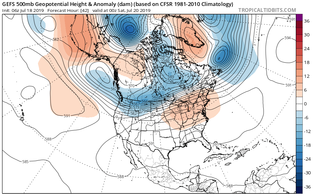 |
| GEFS Forecast of 500mb heights and anomaly (shaded) for 5 PM PDT July 19th, 2019 |
 |
| GEFS Forecast of 500mb heights and anomaly (shaded) for 5 PM PDT July 22nd, 2019 |
Big change as low pressure digs off the coast with a much milder southwest flow. Here is the change in temperature anomaly between July 19th and July 22nd as modeled by the GEFS.
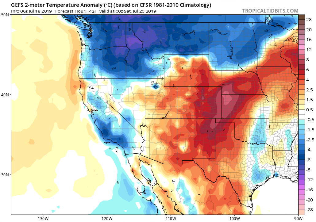 |
| GEFS 2 meter temperature anomaly (degrees C) for 5 PM PDT July 19th, 2019 |
 |
| GEFS 2 meter temperature anomaly (degrees C) for 5 PM PDT July 22nd, 2019 |
No comments:
Post a Comment