
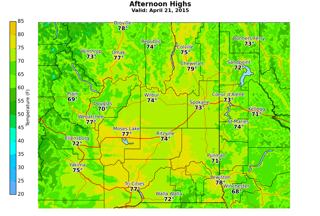
As the map shows temperatures have been running about 1 to 3 degrees below normal over the northwest. Has the snow helped out our mountain snow situation? Here is the latest map showing where we are at

The mountain snow pack has improved very little. While the percent of normal values have increased slightly, they are still below 25% (dark red) or 25-50% of normal (red) for most locations across the Inland NW. Several sites are at or below record low values dating back to the late 1970s or early 1980s.
The weather pattern is currently changing to a warmer one! A strong ridge of high pressure is about to move in and will last awhile. Temperatures Friday through Monday will be above normal, with the warmth possibly peaking on Tuesday. Here is a look at a forecast model showing the general weather pattern for Tuesday.
 |
| 500mb forecast map valid 5 am TUE from the 06z GFS Model run |
What about after that? The ridge may weaken and allow for some cooling although there is quite a bit of uncertainty for the middle to end of next week.
What about May? CPC just released their new monthly and seasonal outlooks this morning (typically issued the third Thursday of every month).

The May outlook is calling for a good chance for warmer than normal temperatures.
What about June, July, and August?

Looks pretty similar, with elevated odds for a warm summer.
No comments:
Post a Comment