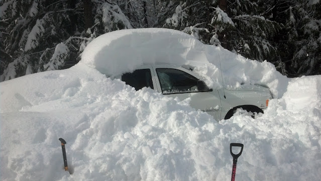
The biggest snow event so far this winter is coming for most areas of the Inland NW. This is especially true if you live in the Cascades including Wenatchee, Leavenworth, Lake Wenatchee which this blog will focus on. Your unattended car in the Cascades could look like this come Thursday with feet of snow in the forecast.
Be prepared for road closures and power outages in Chelan county!
First what is going to cause the snow? Typically we need two things, cold + precipitation. We have the cold as illustrated by temperatures at 10 am this morning.
 |
| Observed surface temperatures 10 am PST January 5th, 2022 |
Temperatures were especially cold in the Cascade valleys with just 4F in Winthrop and 19F in Wenatchee. Next we need a significant source of moisture
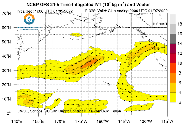 |
| GFS model forecast of Water Vapor Transport valid 4 PM PST Thursday, January 6th, 2022 |
This plot shows the transport of high water vapor (moisture) content towards the area as noted by the orange colors. The moisture plume looks to be directed right at Chelan county, which will be hit with EXTREME SNOW TOTALS! If you live anywhere in Chelan county, or the Wenatchee area, this afternoon is the time to prepare!
How much snow are we talking? Here is the NWS forecast as of Wednesday morning.

One important factor with the snow will be the water content as heavy wet snow can weigh down trees and power lines leading to damage from broken tree limbs and power outages. This looks like a major threat for Chelan county!
Here are couple model depictions courtesy College of Dupage showing as much as 7" of liquid equivalent precipitation for the Cascade crest around Stevens Pass, with significant amounts spilling into Lake Wenatchee and Leavenworth.
 |
| GFS forecast of total precipitation (inches) 4 AM Jan 5- 4 AM Jan 8th, 2022 |
 |
| NAM forecast of total precipitation (inches) 4 AM Jan 5- 4 AM Jan 8th, 2022 |
How confident are we in the heavy snow forecast in the Cascades? The University of Washington has recently developed high resolution modeling where a forecast can be run several times tweaking the initial state of the atmosphere for each forecast, which can give forecasters better information with uncertainty when looking at multiple forecasts as well as different models (also called ensemble forecasting).
The black line is the average of all models.
Let's begin with Stevens Pass (most solutions have 3-4 feet)
 |
| 00z/Jan 5th Stevens Pass accumulative snow accumulation forecast from UW Ensemble Forecast |
Leavenworth (most solutions 20-25")
 |
| 00z/Jan 5th Leavenworth accumulative snow accumulation forecast from UW Ensemble Forecast |
Wenatchee (most solutions show over a foot)
 |
| 00z/Jan 5th Wenatchee accumulative snow accumulation forecast from UW Ensemble Forecast |
Significant amounts of snow are also forecast for the Methow Valley
Winthrop
 |
| 00z/Jan 5th Winthrop accumulative snow accumulation forecast from UW Ensemble Forecast |
How could these totals compare to historic snow events? This will span over a two day period so we looked at max 2 day snow totals on record for Plain, WA (near Lake Wenatchee), and Wenatchee, WA
 |
| Plain, WA Top 2 day snow events |
 |
| Wenatchee, WA top 2 day snow events |
This event could make the top snow event list! One last thing, snow may mix with freezing rain during the event which could make things even more treacherous!
In summary...
- Challenging travel is expected region wide by Thursday morning
- Travel could be extremely challenging in the Cascades and over Lookout Pass with feet of snow in the forecast.
- Be prepared for power outages and road closures in Chelan county as the snow moves in beginning this evening (Wednesday), and intensifies overnight into Thursday.
No comments:
Post a Comment