 |
| 500mb height anomalies for selected time periods since February 2019 |
Lots of colors to look at. The screaming message has been the persistent ridge in the eastern Pacific. It has had varying magnitudes and placement but has been there in some way, shape, or form since February. Last February and March it was very amplified bringing cold and snowy weather to our region.
Over the summer the ridge allowed weather systems to drop down into the area with the # of 90 degree days much lower compared to the past five years.

And then this past October was noteworthy with the coldest October for many across the Inland NW.

Now it's November, and the very amplified ridge has given us a very dry start to the month as well as much of the western US.

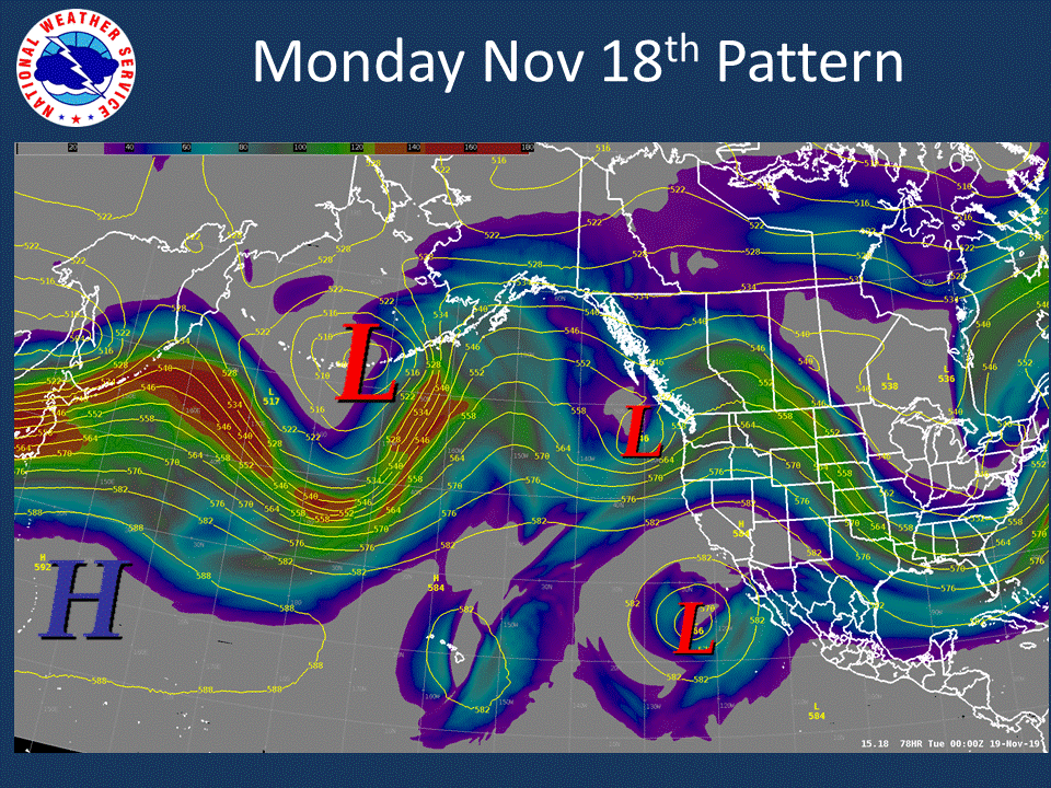
It does look like a weather system will track into the area early next week (Nov 17-19th) time frame bringing rain and high mountain snow. Here is the Nov 18th pattern showing a low off the WA/OR coast with the jet stream over the area.
 |
| 12z Canadian model forecast of 500mb heights and 250mb winds (image) valid 4 PM PST Nov 18th, 2019 |
Don't expect this to be a long lasting change. The ridge returns Wednesday and will probably last through the rest of the week.
 |
| 12z Canadian model forecast of 500mb heights and 250mb winds (image) valid 4 PM PST Nov 20th, 2019 |
So the persistent ridge - what does it mean for this winter? We are looking at a neutral year (neither El Nino or La Nina), which typically brings a lot of variability for our winter weather. But on average, this is the pattern that sets up
 |
| Typical weather pattern for ENSO-Neutral years |
Typically active weather sets up as a Pacific Jet Stream takes aim at the area. With this said, it's interesting that several climate models want to give us a wet December. Here is what the average of the models (NMME forecast) shows.
 |
| NMME model forecast of precipitation anomalies Dec 2019 |
 |
| NMME skill score of precipitation anomalies initialized in November for December |
No comments:
Post a Comment